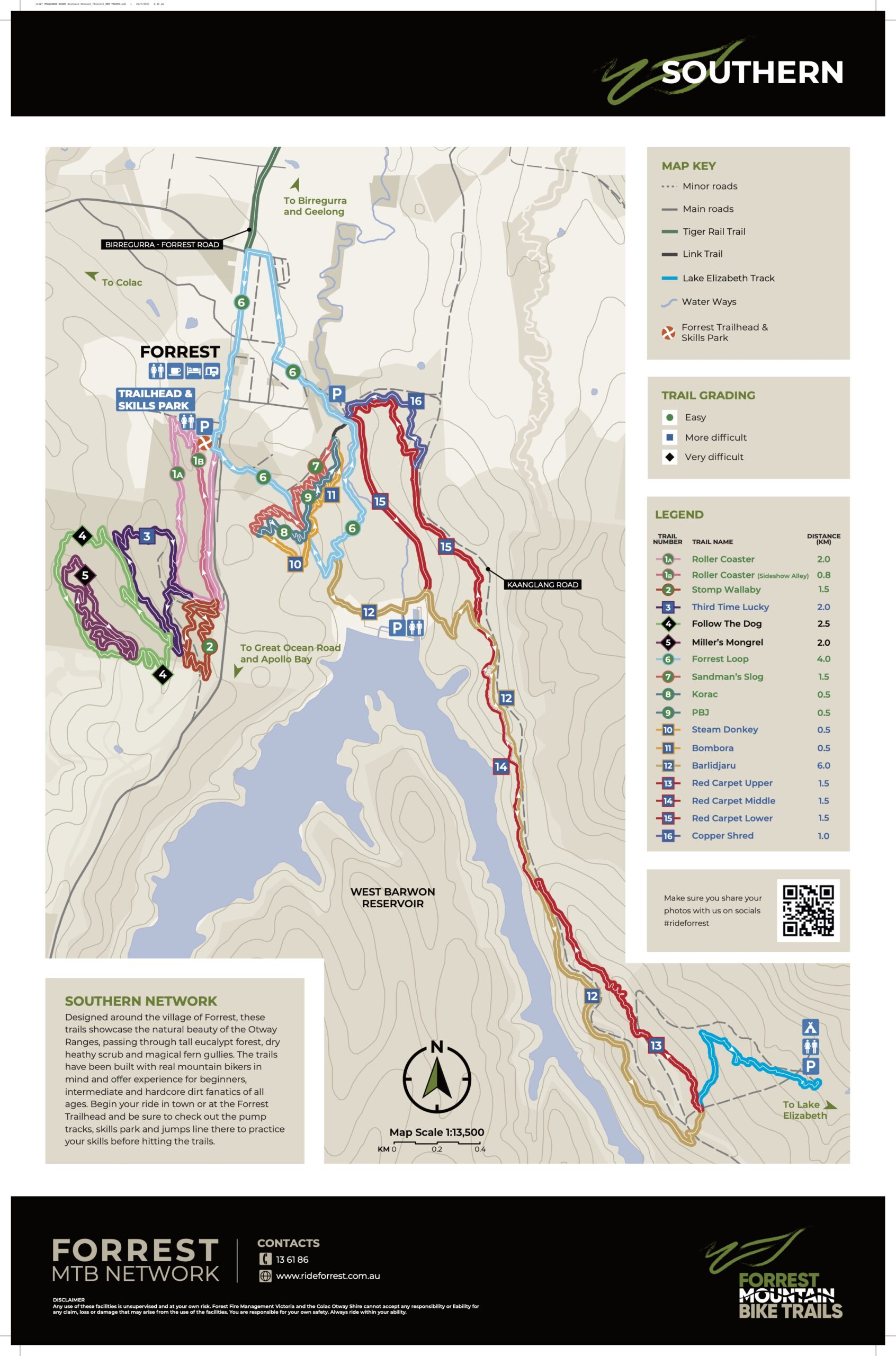
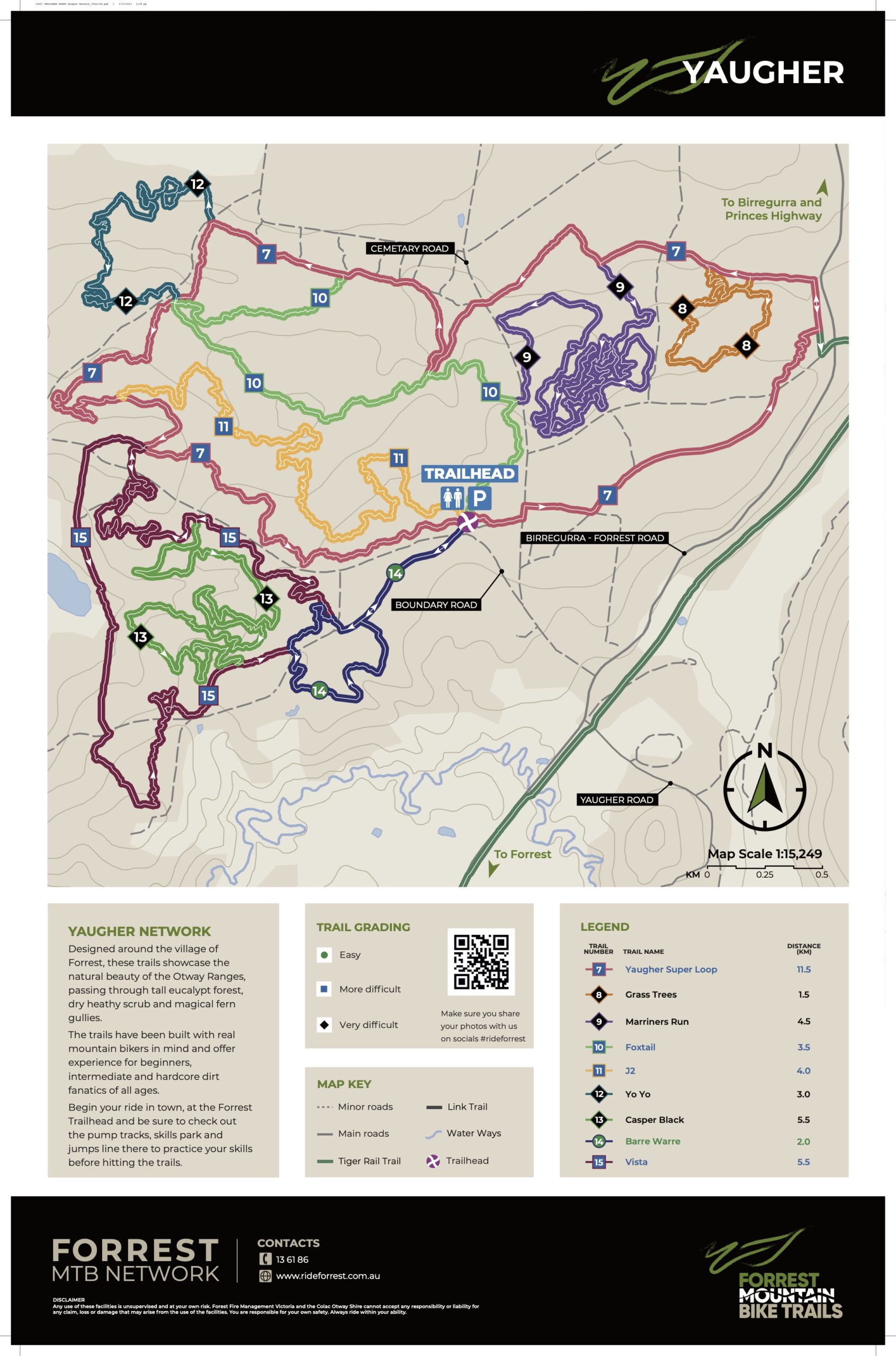
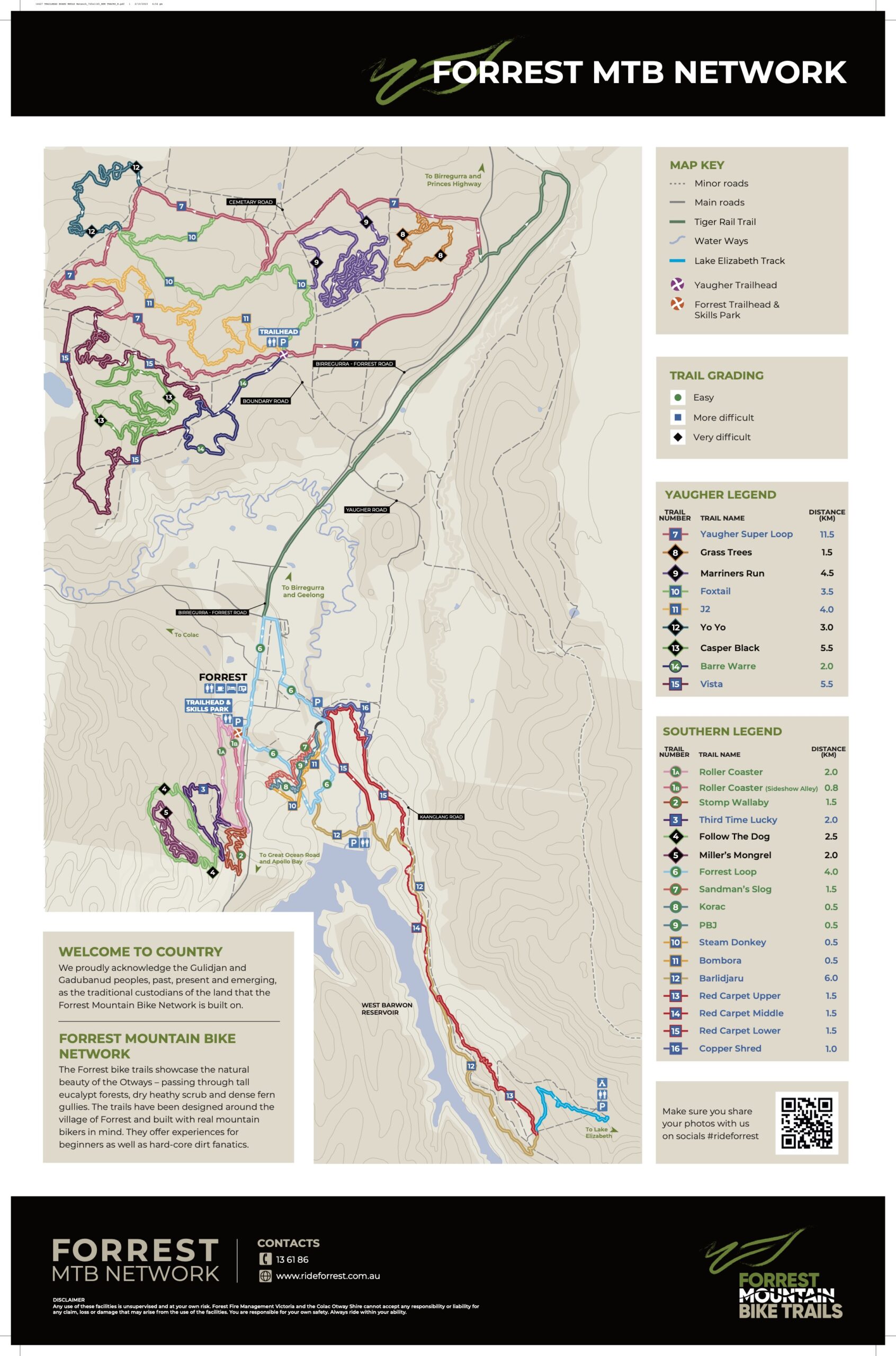
Forrest Trail Maps
We recommend downloading the Trailforks app to help you navigate while riding. It is free to use on the trails that are within your current 5km radius, so when you are in Forrest, it will be free to view our trail network.
Numbering on Trails
In 2022 and 2023, the Southern Trails had a lot of work done - new trails were added, others were resurfaced and realigned. Signage at the Southern Trails is black with trail branding on it. If referring to trails by number, you will need to specify "Number 7 at the Southern Trails" as opposed to "Number 7 at Yaugher".
Current signage at the Yaugher Trails uses small squares with numbers with the background matching trail difficulty eg green circle, blue square, black diamond, or orange fingerboards with trail names.
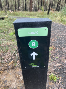
Southern Trails Signage
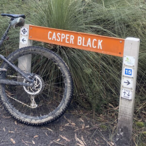
Old Southern Trail/Current Yaugher Signage
